The Art of Land Navigation

Major Mike Sadler passed away this month, aged 103 years. This British Army officer from the Second World War lived an extraordinary life. Though, knowing a bit about him, the word “extraordinary” seems insufficient. Among so much, Sadler was a master of land navigation.
Sadler was one of the first members of the Special Air Service, an elite special operations regiment created in the early years of the war. His task was to guide his patrol in their modified Willys Jeeps, all sporting Vickers K machine guns, along the North African coast to destroy Axis bases and airfields.

Source: Imperial War Museum
Their strategy was effective because, thanks to Sadler and his traditional land navigation skills, the SAS could hide deep in the vast desert to the south where the Germans believed no one could possibly navigate, let alone survive — with its featureless landscapes, blistering sun, and constantly shifting dunes, some 100’s of feet high — then attack them from behind their lines.
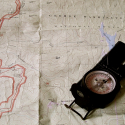
Sadler believed that skilled navigation was a blend of science and art. That is, to effectively travel from one’s current location to another, one needed to first plan the route by computing key data sets with tools like a compass, map, protractor, and even the night sky (the “science”); then, while in transit, adjust the route as needed within the context of a wide mix of ever changing variables, like terrain, weather, and the unexpected, as, in his case, vehicle breakdowns and the periodic strafing Messerschmitt (the “art”). Sadler believed that to effectively combine these two elements requires much preparation, practice, and experience.
Today, in an age of GPS, military personnel have largely forgotten Sadler’s lessons.
To their detriment.
Land Navigation in the Modern Military
More than 80 years later, it shouldn’t be a surprise that the United States special operations community still requires its candidates to demonstrate competence in traditional land navigation techniques during its various selection courses. After all, should a team’s modern electronic tools ever fail on a mission, they still must be able to navigate anywhere as needed, at any time of day, in all conditions, to still accomplish it.
However, the reality is that their actual ability may not be up to the task.
The Department of Defense acknowledges a trend in its recruiting pool for even the most elite units: service personnel have less experience, less ability, and less confidence in using a map and compass than compared to those from 20 years ago.
This doesn’t surprise True North. We regularly train a diverse mix of military personnel in land navigation from the Army, Navy, Marines, and Air Force so we see all types.

Source: Imperial War Museum
Most are in the pipeline for Special Forces, Ranger, or MARSOC selection. We work with members of the Naval Special Warfare community and instructors from Tier Two units. We also offer training to operators gearing up to complete the toughest land navigation course in the U.S military – run by Combat Applications Group, more commonly known as Delta Force.
Many are humble, motivated, and eager to improve any skill that will make them a more proficient warrior. They embrace learning land navigation no matter how frustrating it can be.
And land navigation can certainly be frustrating: it is relatively easy to learn, yet extremely difficult to master. So, they simply keep working at becoming proficient.
By contrast, there are others who view the land navigation phase of their upcoming assessment as simply a temporary hurdle so merely want to learn just enough to pass the test. They seem to have no real expectation that they will ever truly need to use a map and compass operationally.
Probably because they are part of a generation raised fully in the age of the internet, GPS, and smart-phones.
Yet, it’s hard to blame them. The military drifted away over the last three decades from stressing traditional navigation skills. Recruits are given only a few hours of initial training, if any. Many instructors teach poorly because they themselves were taught poorly. And personnel may only receive a few cursory refreshers at various stages in their career, usually as part of a pre-deployment training.
At True North, we stress the fundamentals of traditional land navigation and it’s blend of science and art. Our driving motivation is to provide each of our clients the ability and mindset, not only to pass their upcoming assessment, but, should their electronic tools ever fail during an operation, to still be able to lead others with confidence, accomplish their mission, and return home with pride.
Back in the Desert
Sadler refused to make hunches, even when large sections of his maps were blank (with just the occasional dotted line for “suspected camel track”). When he led his patrol at night, he would spend much of it searching for suitable stars. During the day when he dead-reckoned, he carefully calculated his current position by tracking his convoy’s speed. That’s how Sadler was once able to lead his patrol over 400 miles through the Libyan desert for a raid against the Wadi Tamet airbase, then escape back amongst the dunes.
Surprisingly, Sadler considered his ability only marginal.
Not surprisingly, Sadler offers all of us so many lessons … about more than just land navigation.
——————————–
If you or your unit would like training in land navigation, just contact us, or check out our Mil-Nav Program for information. We offer training for a mix of skill levels, from beginner to those preparing for Delta.

